 Flat Earth Claim that Sun Acts Like a "Spotlight" -- DISPROVED!
New Mexicans for Science and Reason
presents
Flat Earth Claim that Sun Acts Like a "Spotlight" -- DISPROVED!
by Dave Thomas

Flat Earthers like to say that the Sun casts like like a spotlight as it floats above the flat earth, which explains day and night. This page shows that this claim, pictured below, is FALSE.

The following images and animations show three different types of Map Projections: The Orthographic Projection (which looks like a Globe, viewed from various directions), the Mercator Projection (commonly used, although it makes arctic regions like Greenland appear too large), and the Polar Azimuthal Equidistant Projection (which Flat Earthers claim is the only proper representation of the Flat Earth).
The maps and animations which follow show the progression of Day and Night in both summer and winter.
This map shows night and day for the Summer Solstice, for noon in Sydney, Australia. Note that the three map projections all indicate that Alaska, Russia and northern Greenland are in sunlight, while nighttime is happening in Florida, South America and Africa.

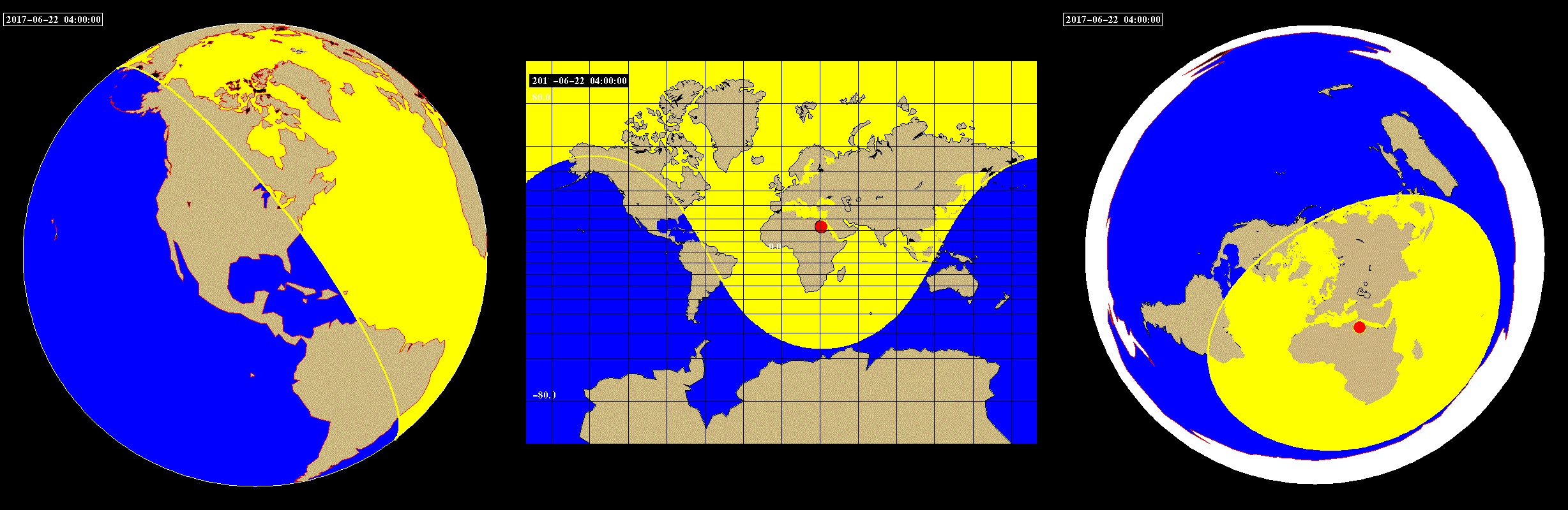
This next map shows night and day for the Summer Solstice, for noon in Cairo, Egypt. Note that the three map projections all indicate that Maine and Brazil are in sunlight, while nighttime is happening in Alaska, Florida and western South America.
Here are animations of each of the three projections, for a Summer Solstice day.
Note that the northern Arctic is in sunlight all day, as this is the time for "Land of the Midnight Sun" in the north.
Also note that the Sun (red circle) goes above China, Saudi Arabia, the Sahara Desert, and Mexico in each map projection.
The Polar Azimuthal map shows that daylight changes as indicated in the Flat Earth animation above. Also note, however, that all three animations show the same countries and cities experiencing Night and Day.


These next maps show night and day for the peak of Winter. This is when it gets rather thorny for the Flat Earth Movement.
This map shows night and day for the Winter Solstice, for noon in Greenland. Note that the three map projections all indicate that South America, Africa and southern Greenland are in sunlight, while nighttime is happening in Alaska, northern Greenland, and Norway.
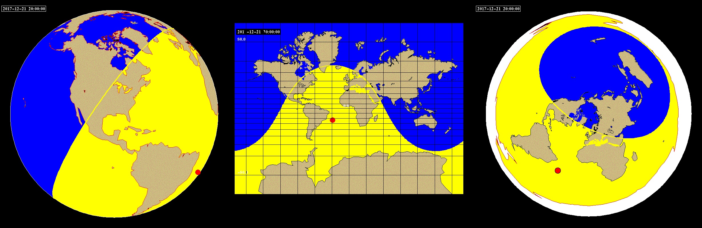
This next map shows night and day for the Winter Solstice, for noon in Anchorage, Alaska. Note that the three map projections all indicate that Alaska, Florida and western South America are in sunlight, while nighttime is happening in Maine and Brazil.

Here are animations of each of the three projections, for a Winter Solstice day.
Note that Antarctica is in sunlight all day, as this is the time for "Land of the Midnight Sun" in the south. Note carefully that the northern part of Greenland is
in night the whole time, and that only the southern tip of Greenland gets any sunlight at all, in all three map projections.
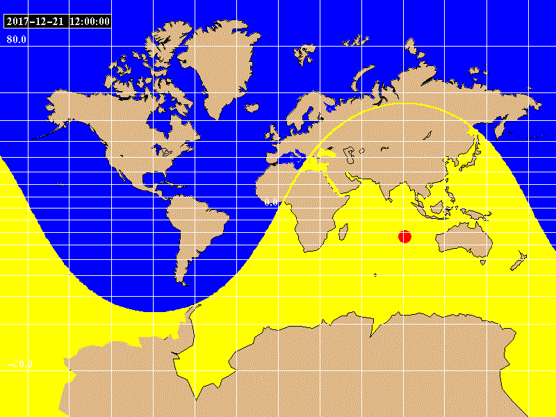
Also note that the Sun (red circle) goes above Australia, Madagascar, southern Africa, and South America in each map projection.
This time, however, daylight does NOT change as indicated in the Flat Earth animation above.

This is the Smoking Gun: In Winter, on the Flat Earth Map, the "Sun" would have to project light all over the earth, including all of Antarctica, while at the same time not shining a spotlight on half of the Earth. The animation below shows the shape of the required solar "spotlight" in winter. No spotlight can make such a pattern. And so, the Flat Earth is FALSE.

Last Update: Oct. 8th, 2017
Try these other NMSR Pages on Flat Earth:
 December 12th, 2018 NMSR Meeting: Bruce Lacey, on "A Flat Earther's Journey and Perspective"